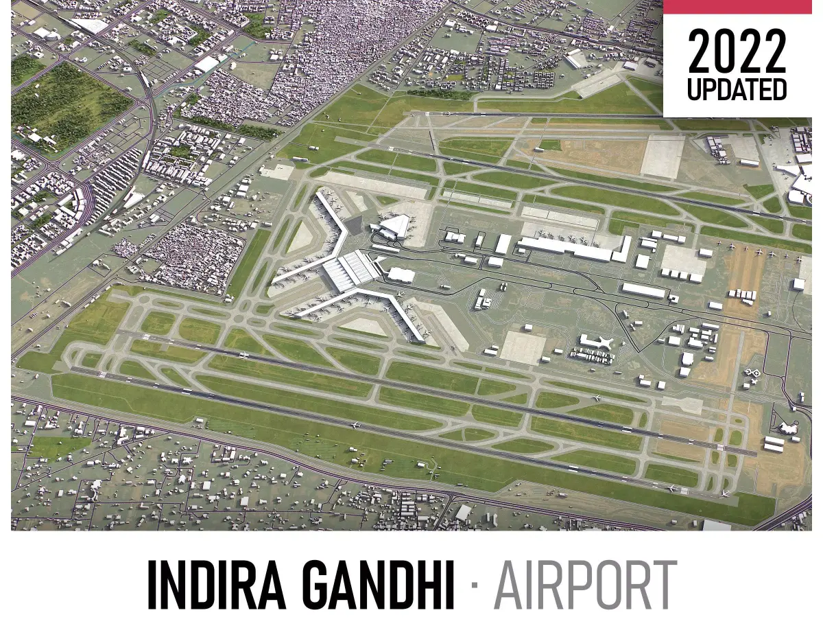
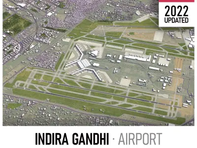
- Coordinate reference system: IndiaPolyConic (SR-ORG:7345)
- Scene size: 15 x 15 km
- Units: Meters
- Scale: 1 : 1
- Data used: November 2022
- SEND US A MESSAGE BEFORE YOU BUY
- Get FREE sample model - www.each.city/sample
- Customization requests
- Any scene size (custom area crop)
- Any coordinate reference system
- Various levels of detail (LODs)
- Update to the latest data
- Flexible pricing (select only the options you need)
- PACKAGE CONTENTS
- This product includes scenes of various sizes and formats
- File formats (software supported)
- MAX - Autodesk 3dsMax
- FBX, OBJ, DAE - Exchange Formats
- GLTF, GLB - Games, Web, AR/VR (request)
- UNITYPACKAGE - Unity 3D
- 3DM - Rhino 3D
- SKP - SketchUp
- RVT - Autodesk Revit (request)
- STL - 3D Print (request)
- C4D - Cinema4D
- BLEND - Blender
- MA, MB - Autodesk Maya
- DWG, DXF - Autodesk AutoCAD
- BASIC OPTIONS (included with the purchase)
- KEY BENEFITS
- 24/7 customer support
- High-resolution surface texture (1 meter resolution satellite image)
- Buildings, landuse areas, roads and railways split by type (layers / named objects)
- The surface is flat, easy to add details and edit geometry
- Realistic low-poly trees, forests and airplanes (max, fbx included, other formats on request)
- Product is ready to render out-of-the-box (3ds Max + Corona Renderer)
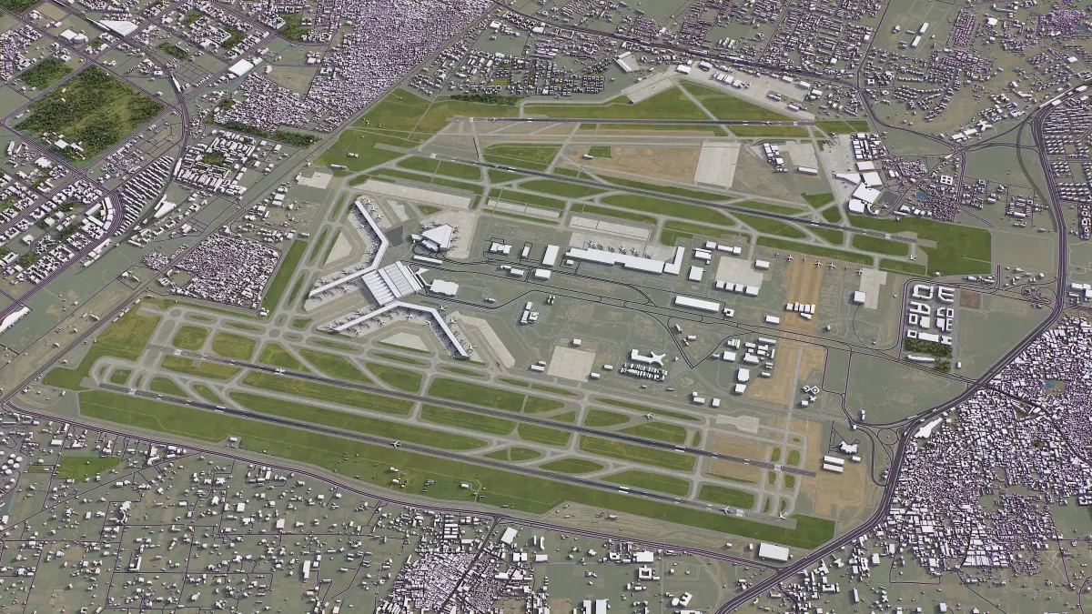
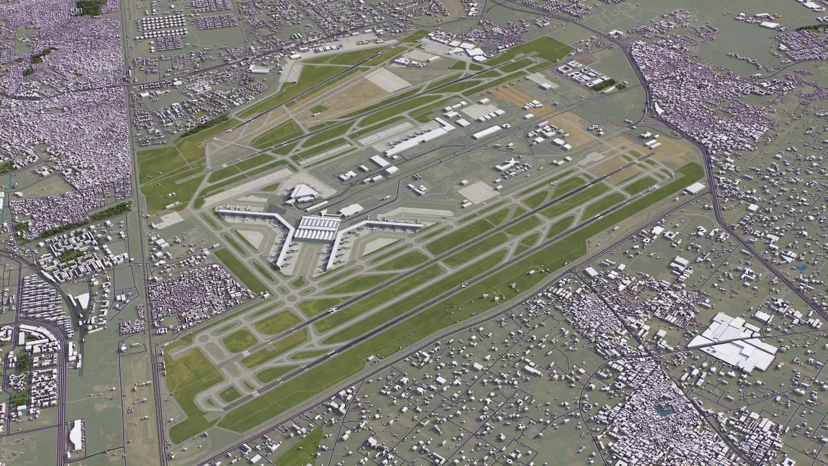
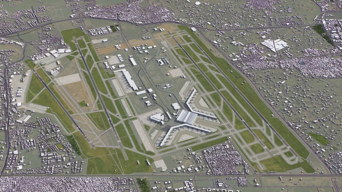
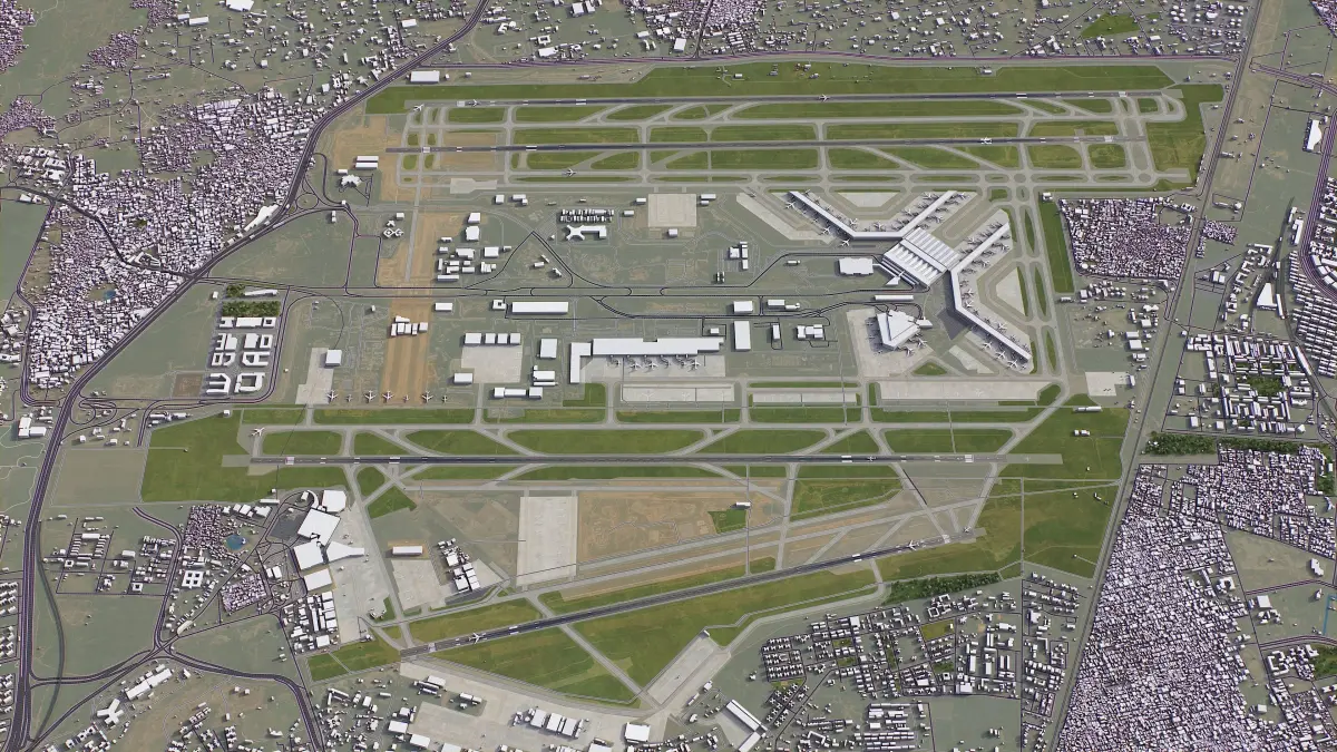
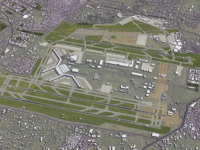
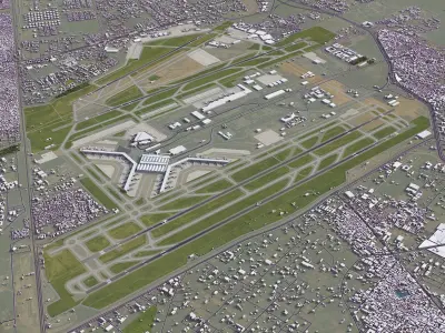
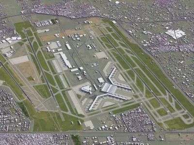
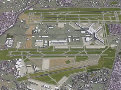
- PRESENTATION IMAGES
- 4K high-resolution realistic renderings (refer to images for level of detail or request close-ups)
- Rendered in 3dsMax (other software requires its own rendering settings)
- MATERIALS
- Trees, vegetation, landuse and airport surface with the textures assigned
- Buildings are UVW mapped, split by material IDs, no textures assigned
- CUSTOM OPTIONS (available at a special price - please request before buying)
- TOPOGRAPHY TERRAIN
- Up to 1 meter accuracy raw terrain object (USGS 3D Elevation Program)
- Multiple LODs optimized for the best polycount/details balance
- Contour lines (up to 1 meter interval)
- High-resolution (up to 20cm accuracy) satellite or surface texture
- Buildings and roads placed on the optimized terrain
- OTHER EXTRAS
- On-demand custom update
- Crop to custom area size or slice to tiles
- Procedural textures assigned to all buildings
- Individual buildings and streets (with address and/or name)
- Road, railway and airways splines for traffic animation
OBJ (OBJ, filesize: 114 MB), BLEND (Blender, filesize: 79.5 KB), 3DM (Rhinoceros 3D, filesize: 4.01 KB), C4D (Cinema 4D, filesize: 83.3 MB), FBM (fbm, filesize: 83.3 MB), DXF (DXF, filesize: 130 MB), DWG (AutoCAD, filesize: 87.7 MB), MAX (Autodesk 3ds Max, filesize: 271 MB), FBX (Autodesk FBX, filesize: 202 MB), GLTF (glTF, filesize: 96.6 MB), MA (Autodesk Maya, filesize: 7.33 KB), DAE (Collada, filesize: 203 MB), SKP (Sketchup, filesize: 2.27 MB), RFA (Autodesk Revit, filesize: 5.6 MB), UNITYPACKAGE (Unity 3D, filesize: 7.35 KB)