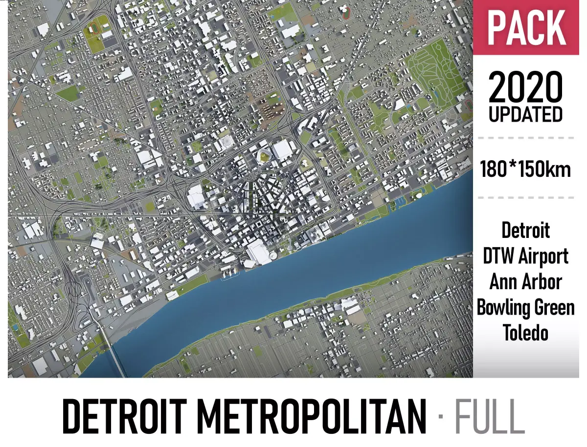
This is the exact and accurate to-scale 3D model of the entire Detroit area (180 x 150 km) based on GIS data (January 2020)
- This 3D city is georeferenced, exact and accurate to real-world scale
- File units: Meters
- Scale: 1:1
NO MISSING BUILDINGS!
- This is the only product on the market with 100% buildings coverage from 125,192,184 buildings footprint polygon geometries in all 50 U.S. States
COLLECTION
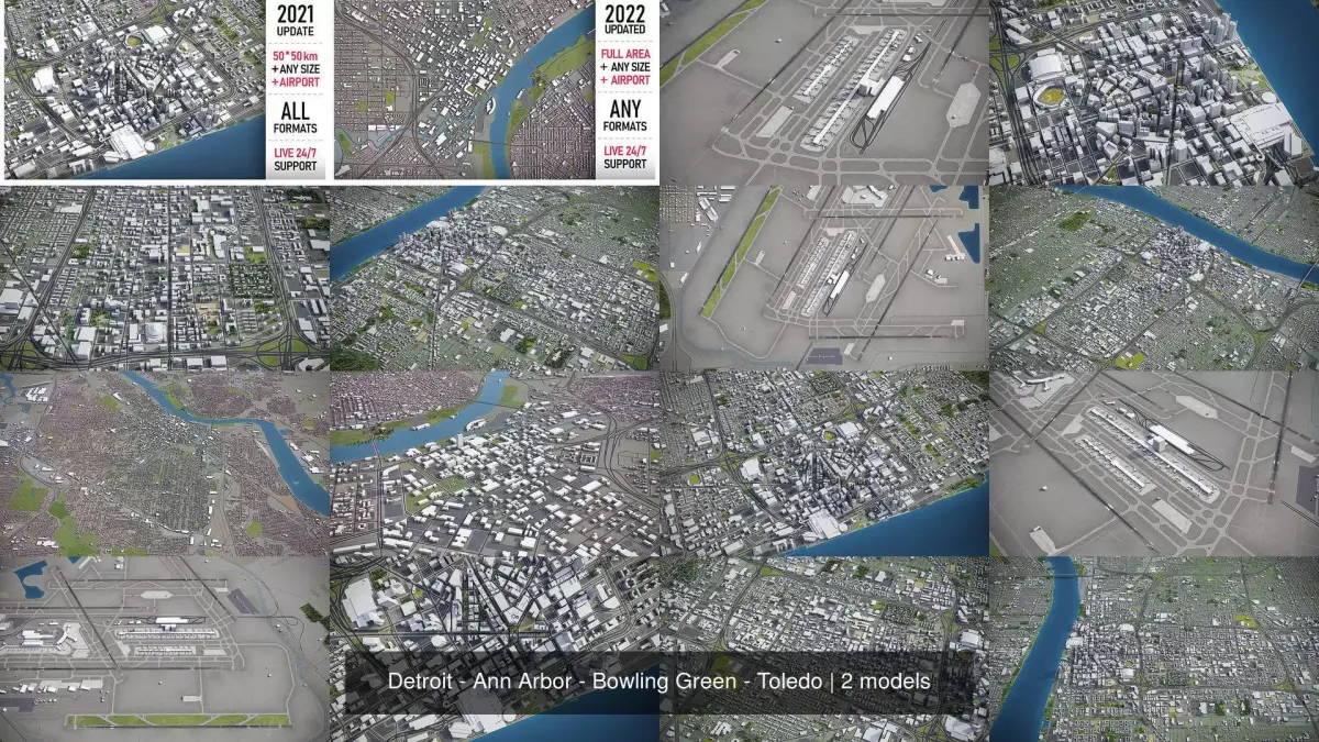
- This collection includes 5 scenes of different size
- Detroit
- Detroit Metropolitan Wayne County Airport (DTW)
- Ann Arbor
- Bowling Green
- Toledo
- FORMATS INCLUDED
- MAX - Autodesk 3dsMax
- FBX, OBJ, DAE - Exchange Format
- UNITYPACKAGE - Unity 3D
- 3DM - Rhino 3D
- SKP - SketchUp
- BLEND - Blender
- RVT - Autodesk Revit / request
PRODUCT INFO
- USAGE
- This model is suitable for visualization, AR/VR, real-time and game use, architecture, consulting, education
- Perfect for town and urban planning, real estate and property development
- KEY BENEFITS
- This 3D city model is georeferenced, exact and accurate to real-world scale
- Buildings, landuse areas, roads and railways split by type (see scene structure)
- Surface is flat, easy to add details and edit geometry (terrain on request)
- Realistic low-poly trees and forests
- Ready to render out-of-the-box (3dsmax + corona renderer)
- EXTRAS (on request)
- Administrative boundaries of all levels (named polygons or outlines)
- Road and railway splines for traffic animation
- Public transport stops with names
- PRESENTATION IMAGES
- 4K high-resolution images available for the download
- Ready to render out-of-the-box (3dsmax + corona renderer)
- MATERIALS
- Buildings are UVW mapped, material IDs used (wall, roof, brick, glass, etc.)
- Trees, vegetation, landuse and airport objects with the textures assigned
SCENE STRUCTURE - model is organized by layers, all objects split by type and named properly
- BUILDINGS
- residential
- commercial
- industrial
- public
- sports
- parkings
- transport
- ROADS
- highways
- primary
- secondary
- tertiary
- residential
- service
- RAILWAYS
- train
- city tram
- subway
- monorail
- PAVEMENT
- sidewalk
- footway
- cycleway
- LANDUSE
- residential
- public
- industrial
- construction
- agriculture
- VEGETATION
- forest
- grass
- scrub
- park
- garden
- cemetery
- recreation
- NATURAL
- AIRPORT
- building (terminal, gates)
- apron
- taxiway
- runway
SUPPORT - please send us a message 24/7
- FREE - Product update with the latest GIS data
- $299+ - Request any other city or area (same day delivery)
- $199+ - Add terrain based on SRTM or LIDAR elevation data (3-5 LODs optimized)
MAX (Autodesk 3ds Max, filesize: 514 MB), BLEND (Blender, filesize: 375 MB), OBJ (OBJ, filesize: 542 MB), FBX (Autodesk FBX, filesize: 646 MB), MAX (Autodesk 3ds Max, filesize: 514 MB), C4D (Cinema 4D, filesize: 348 MB), MA (Autodesk Maya, filesize: 434 MB), GLTF (glTF, filesize: 259 MB), DXF (DXF, filesize: 459 MB), DAE (Collada, filesize: 541 MB), DWG (AutoCAD, filesize: 535 MB), 3DM (Rhinoceros 3D, filesize: 712 MB), FBM (fbm, filesize: 769 MB), SKP (Sketchup, filesize: 674 MB), UNITYPACKAGE (Unity 3D, filesize: 542 MB), 3DS (3D Studio, filesize: 259 MB), RFA (Autodesk Revit, filesize: 259 MB), PDF (PDF, filesize: 16.2 MB), LS10 (Lumion, filesize: 16.2 MB), STL (Stereolithography, filesize: 16.2 MB), UASSET (UnrealEngine, filesize: 16.2 MB)