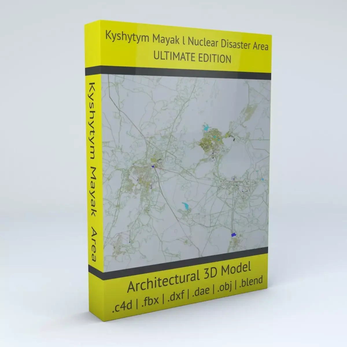
- Kyshtym Mayak Nuclear Disaster Area Ultimate Edition 3D model is based on real data therefore this is a realistic buildings and streets setup of the Kyshtym Mayak Nuclear Disaster Area, Russia (at the time of the accident Soviet Union in September 29, 1957)
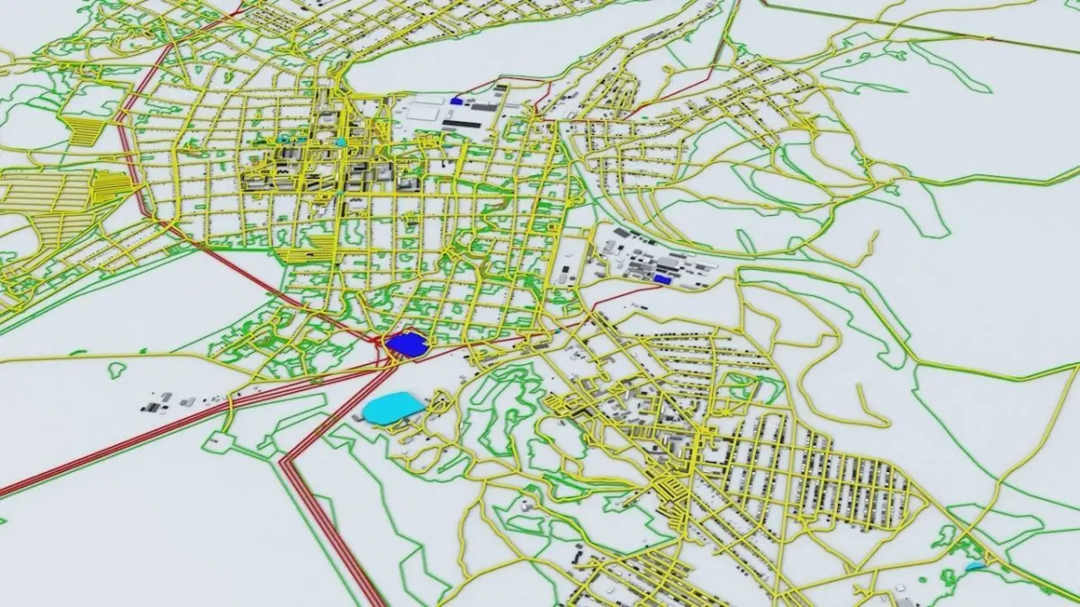
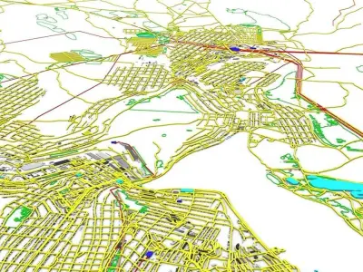
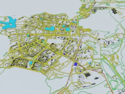
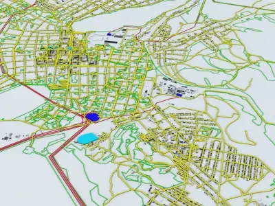
- this 3D model covers a more than 125km x 125km (15625 sqkm) / 78miles x 78miles (6084 sqmiles) area of the Kyshtym Mayak Nuclear Disaster Area/Zone including road networks, streets and buildings, the South Urals Nuclear Power Plant and nuclear fuel, fissile material storage facility, the town of Kyshtym – Mayak Ozersk and the surrounding areas in the Chelyabinsk Oblast
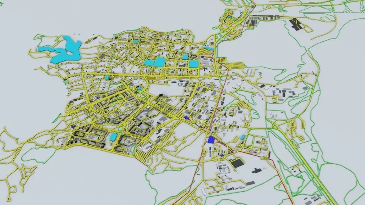
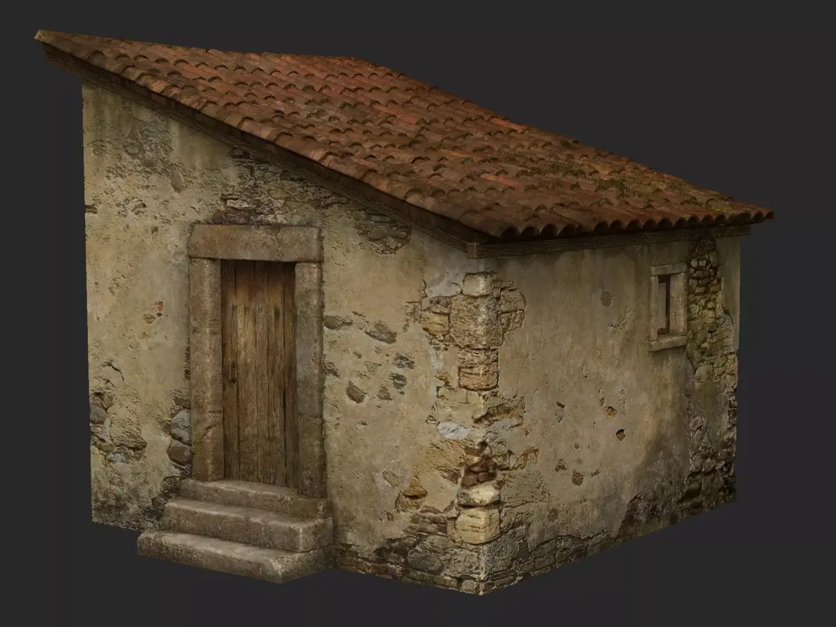
- 5 building groups are setup so that you can add variety to buildings (color materials and/or textures) Groups can be turned off/on
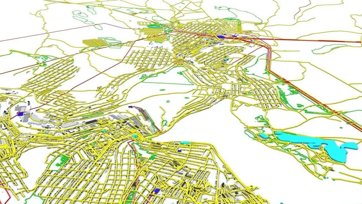
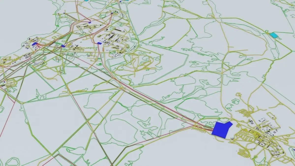
- road networks are included (yellow in the preview images)
- 3D models are UV mapped with overlapping UVs except the terrain texture that have non-overlapping/unwrapped UV
- the model is positioned on a flat surface (all buildings are on the “floor” - no elevation data included)
- geometry is polygonal quads and tris
- materials included for better distinctioning
- 1 color terrain texture included – 6144 x 6144 pixels (37.7 MP) / not detailed enough for closeup terrain renders but can be perfectly used for satelite design imagery
- power lines (red) and power stations (blue) in/out the power plant are included
natural areas and zone borders (green)
this 3D model is/can be licensed (commercial use is fine) under Creative Commons Attribution-ShareALike 2.0 (CC-BY-SA) license
buildings and streets data from OpenStreetMap / www.openstreetmap.org
Attribution : © OpenStreetMap contributors / CC BY SA 2.0 http://www.openstreetmap.org/copyright
POINTS/VERTS : 5205479POLYGONS : 4798336
- .c4d - native format
- .fbx - v7.1
- .dae – v1.5
- .dxf
- .obj
- .blend
C4D (Cinema 4D, filesize: 111 MB), BLEND (Blender, filesize: 211 MB), OBJ (OBJ, filesize: 260 MB), FBX (Autodesk FBX, filesize: 142 MB), DAE (Collada, filesize: 120 MB), DXF (DXF, filesize: 95 MB)