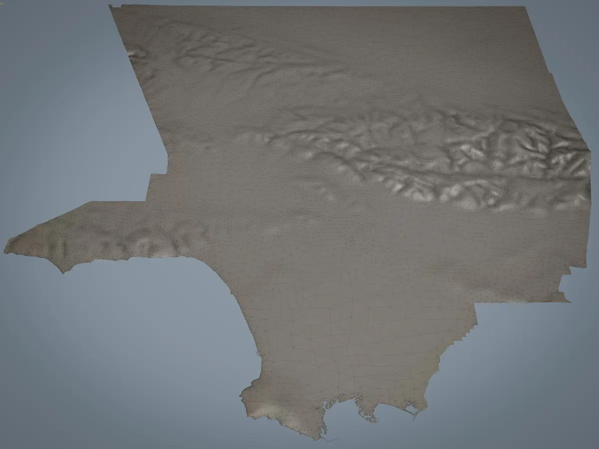
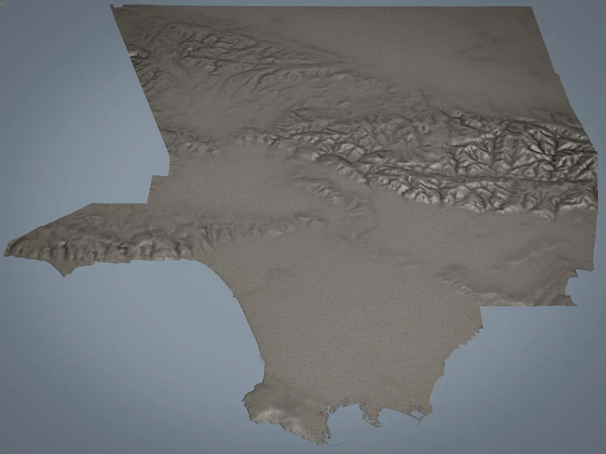
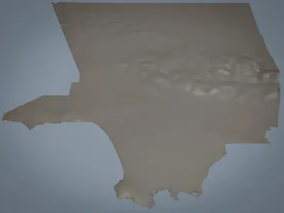
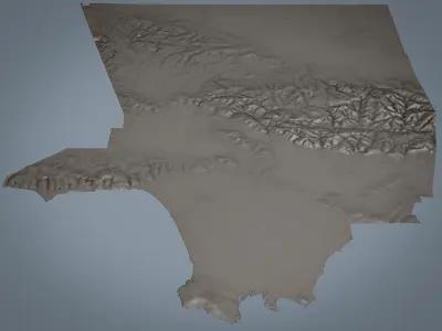
This is exact and accurate to scale 3D terrain model of the entire Los Angeles County, California
- Georeferencing: Transverse Mercator projection
- Dimensions: 150 x 150 x 3 km
- File units: Meters
- Scale: 1:1
MEGAPACK
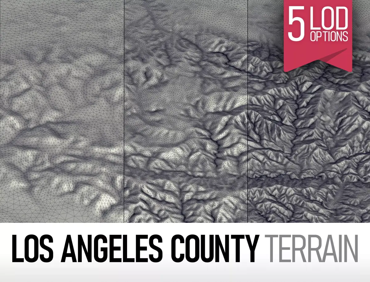
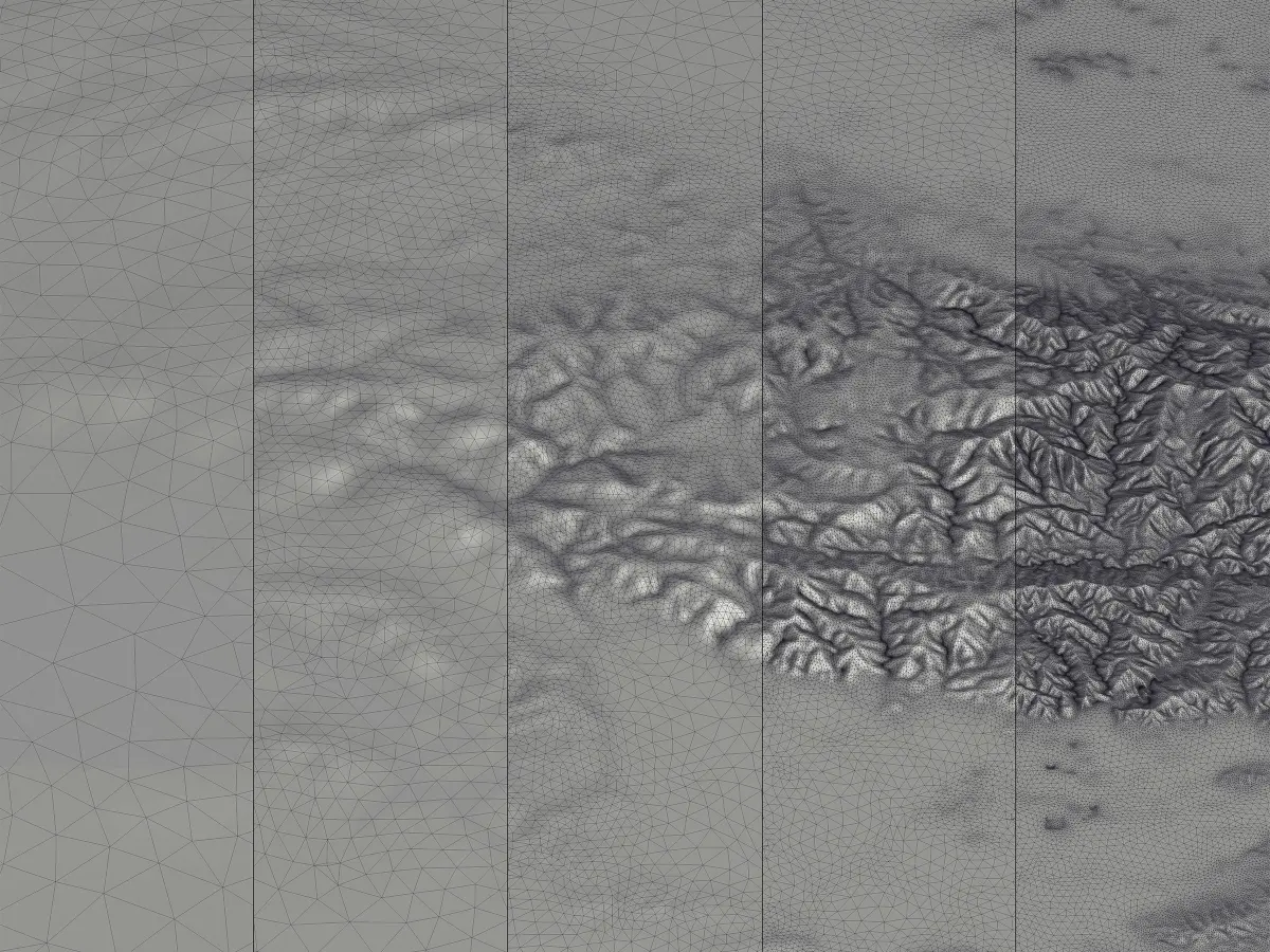
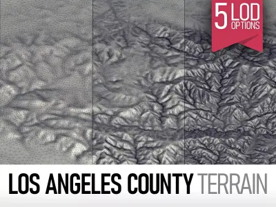
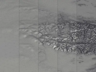
- This collection includes 5 LODs (levels of detail)
- You may purchase any LOD with extra discount!
- Polycount - polygons / vertices
- LOD 1 - 14.060 / 9.612
- LOD 2 - 31.942 / 18.676
- LOD 3 - 109.706 / 57.886
- LOD 4 - 421.940 / 214.717 - 3D print ready
- LOD 5 - 1.455.913 / 733.215
FORMATS
- MAX - 3dsMax (V-Ray and Standard materials)
- FBX, OBJ, DAE - Exchange Formats
- BLEND - Blender
- SKP - SketchUp
- 3DM - Rhino 3D
- STL - Stereolithography (3D print ready)
KEY BENEFITS
- This is DTM (Digital Terrain Model) based on latest SRTM data, exact and accurate to real-world scale
- Each LOD processed and optimized manually to maintain perfect polycount/detail balance
SUPPORT - please send us a message 24/7
- Request any other city, area or terrain (same day delivery)
- High-resolution satellite image (ECW or JP2, up to 32000x32000px, with georeferencing)
MAX (Autodesk 3ds Max, filesize: 41.9 MB), BLEND (Blender, filesize: 8.17 MB), OBJ (OBJ, filesize: 121 MB), FBX (Autodesk FBX, filesize: 84.7 MB), C4D (Cinema 4D, filesize: 8.17 MB), MA (Autodesk Maya, filesize: 8.17 MB), GLTF (glTF, filesize: 8.17 MB), DWG (AutoCAD, filesize: 29.6 MB), DAE (Collada, filesize: 121 MB), 3DM (Rhinoceros 3D, filesize: 21.8 MB), STL (Stereolithography, filesize: 17.1 MB), PDF (PDF, filesize: 8.17 MB), 3DS (3D Studio, filesize: 8.17 MB), LS10 (Lumion, filesize: 8.17 MB), RFA (Autodesk Revit, filesize: 8.17 MB), SKP (Sketchup, filesize: 8.17 MB), UASSET (UnrealEngine, filesize: 8.17 MB), UNITYPACKAGE (Unity 3D, filesize: 8.17 MB)