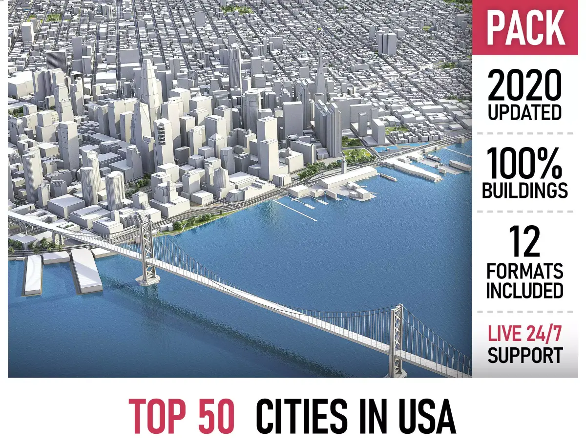
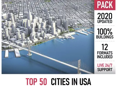
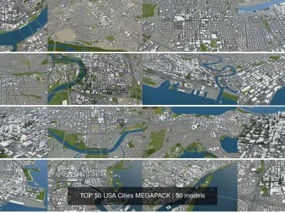
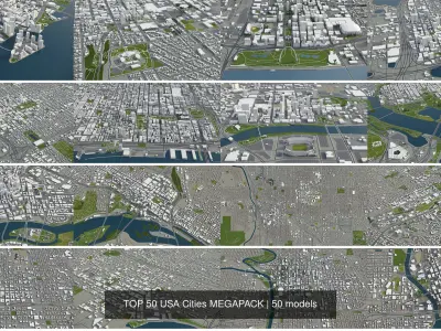
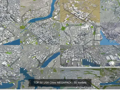
Collection of the Top 50 US cities with the surrounding area based on GIS data (April 2019)
THIS IS THE ONLY PRODUCT ON THE MARKET WITH 100% BUILDINGS COVERAGE FROM 125,192,184 BUILDING FOOTPRINT POLYGON GEOMETRIES IN ALL 50 U.S. STATES
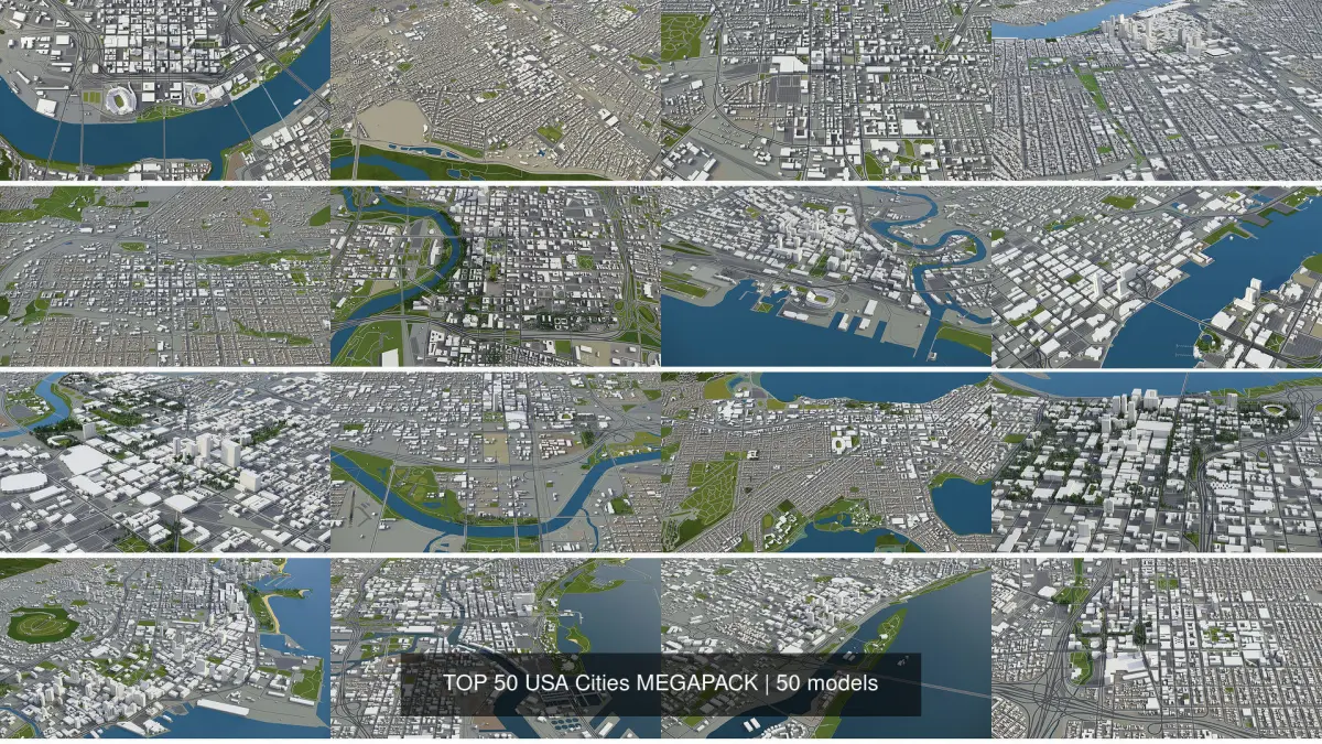
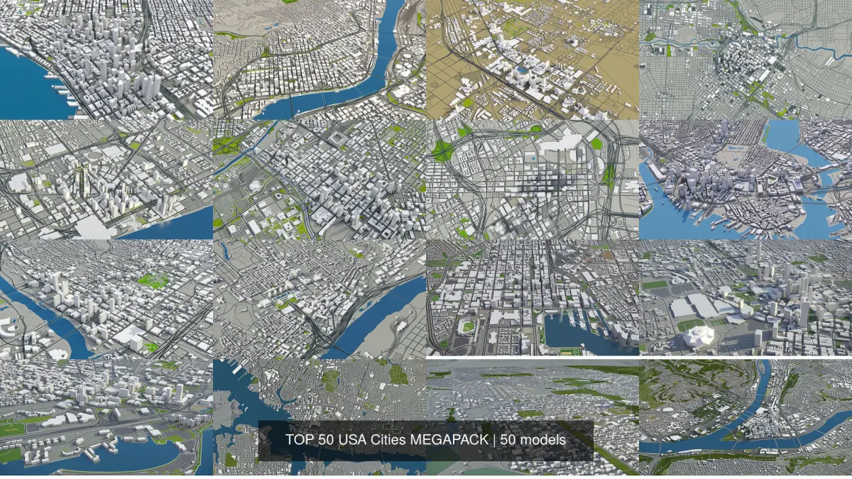
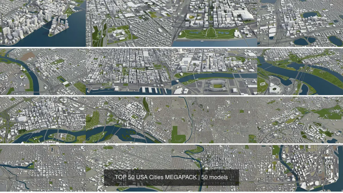
COLLECTION
- Albuquerque
- Anchorage
- Atlanta
- Austin
- Baltimore
- Boston
- Buffalo
- Charlotte
- Chicago
- Cincinnati
- Cleveland
- Columbus
- Dallas
- Denver
- Detroit
- Honolulu
- Houston
- Indianapolis
- Jacksonville
- Las Vegas
- Los Angeles
- Louisville
- Madison
- Memphis
- Miami
- Milwaukee
- Minneapolis
- Montgomery
- Nashville
- New Orleans
- New York
- Norfolk
- Oklahoma City
- Orlando
- Philadelphia
- Phoenix
- Pittsburgh
- Portland
- Richmond
- Sacramento
- Salt Lake Сity
- San Antonio
- San Diego
- San Francisco
- San Jose
- Seattle
- St. Louis
- Tampa
- Tucson
- Washington
- FORMATS INCLUDED
- MAX - Autodesk 3dsMax
- FBX, OBJ, DAE - Exchange Format
- UNITYPACKAGE - Unity 3D
- 3DM - Rhino 3D
- SKP - SketchUp
- BLEND - Blender
- C4D - Cinema4D
- MA, MB - Autodesk Maya
- DWG - Autodesk AutoCAD
- RVT - Autodesk Revit / request
PRODUCT INFO
- KEY BENEFITS
- Live 24/7 support (format conversion, software adjustment, area cropping, etc.)
- This 3D city model is georeferenced, exact and accurate to real-world scale
- Buildings, landuse areas, roads and railways split by type (see scene structure)
- The surface is flat, easy to add details and edit geometry (terrain on request)
- Realistic low-poly trees and forests
- EXTRAS (on request)
- Administrative boundaries of all levels (named polygons or outlines)
- Road and railway splines for traffic animation
- Public transport stops with names
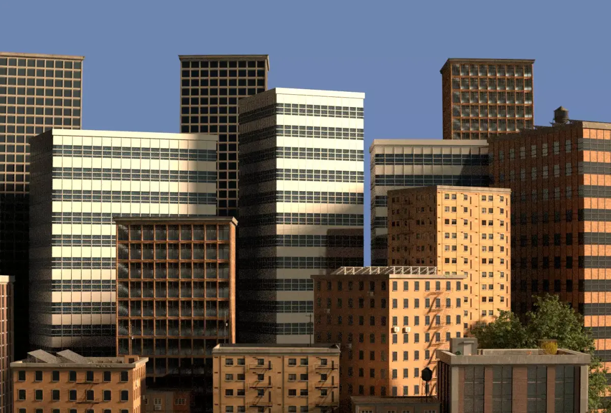
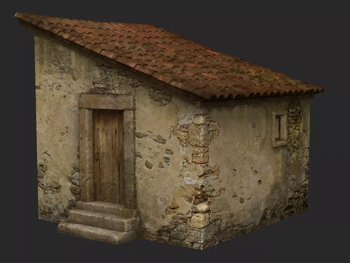
- PRESENTATION IMAGES
- Product is ready to render out-of-the-box (3dsmax + corona renderer)
- 4K high-resolution realistic renderings (refer to images for level of detail)
- MATERIALS
- Buildings are UVW mapped, split by material IDs, no textures assigned
- Trees, vegetation, landuse and airport surface with the textures assigned
SCENE STRUCTURE - model is organized by layers, all objects split by type and named properly
- BUILDINGS
- residential
- commercial
- industrial
- public
- sports
- parkings
- transport
- ROADS
- highways
- primary
- secondary
- tertiary
- residential
- service
- RAILWAYS
- train
- city tram
- subway
- monorail
- PAVEMENT
- sidewalk
- footway
- cycleway
- LANDUSE
- residential
- public
- industrial
- construction
- agriculture
- VEGETATION
- forest
- grass
- scrub
- park
- garden
- cemetery
- recreation
- NATURAL
- AIRPORT
- building (terminal, gates)
- apron
- taxiway
- runway
SUPPORT - please send us a message 24/7
- FREE - Product update with the latest GIS data
- $299+ - Request any other city or area (same day delivery)
- $199+ - Add terrain based on SRTM or LIDAR elevation data (3-5 LODs optimized)
MAX (Autodesk 3ds Max, filesize: 27 GB), BLEND (Blender, filesize: 6.09 GB), OBJ (OBJ, filesize: 16.3 GB), FBX (Autodesk FBX, filesize: 17.7 GB), MAX (Autodesk 3ds Max, filesize: 27 GB), C4D (Cinema 4D, filesize: 4.19 GB), MA (Autodesk Maya, filesize: 7.07 GB), GLTF (glTF, filesize: 1.07 GB), DWG (AutoCAD, filesize: 13.4 GB), OTHER (Other, filesize: 1.41 GB), DAE (Collada, filesize: 15 GB), FBM (fbm, filesize: 3.25 GB), UNITYPACKAGE (Unity 3D, filesize: 12.3 GB), 3DM (Rhinoceros 3D, filesize: 16.1 GB), 3DS (3D Studio, filesize: 921 MB), SKP (Sketchup, filesize: 11.3 GB), RFA (Autodesk Revit, filesize: 2.86 GB), DXF (DXF, filesize: 9.67 GB), PDF (PDF, filesize: 193 MB), LS10 (Lumion, filesize: 193 MB), STL (Stereolithography, filesize: 193 MB), UASSET (UnrealEngine, filesize: 193 MB), TM (Twinmotion, filesize: 16.7 MB), JPG (JPG, filesize: 564 MB), PNG (PNG, filesize: 156 MB), TEXTURES (Textures, filesize: 84 MB)